Keywords:Colorado, Gunnison, Montrose, Rim Rock Trail, black, canyon, landscape, rock, scenic, south rim
Photo Info
Dimensions1280 x 674
Original file size575 KB
Image typeJPEG
Color spacesRGB
20150915 [C] CO - Vacation 2015 823-Edit
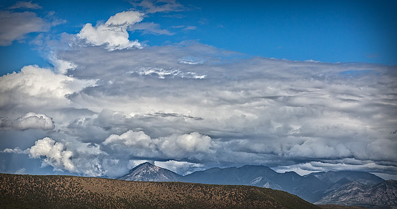
Black Canyon of the Gunnison A convective storm cell is the cause of a wet microburst impacting and spreading out along an 1100+ foot wide area on the left flank of Landsend Peak (seen behind the foreground mesa named Green Mountain). "Corkscrew" clouds spiraling away from the base of the mountain are likely artifacts of other recent microbursts that had occurred in the area. Mount Gunnison and the West Elk mountains are to the right of Landsend Peak, beneath the dark storm clouds.
I would like to thank Amanda Christensen (Park Ranger) and Paul Zaenger (Supervisory Park Ranger) at Black Canyon National Park for their assistance in identifying the prominent mountains in this view photographed from Cedar Point on the canyon's south rim. I would also like to thank NOAA's National Severe Storms Laboratory in Norman, OK for their meteorological expertise and interpretation of the atmospheric features captured in this photograph.